The Israel E1 map is a focal point in Jerusalem’s urban planning and regional politics. Known in full as the E1 corridor map, this cartographic image outlines a proposed or planned zone that would connect the east of Jerusalem with the West Bank settlement of Ma’ale Adumim. This guide explores the E1 map of Jerusalem from multiple angles—its geography, history, planning implications, and the wide-ranging political debates it has sparked. Whether you refer to it as the Israel E1 map, the E1 planning map, or the E1 corridor map, the core questions are the same: what would this corridor look like on the ground, and what would it mean for the city’s future and for the broader Israeli-Palestinian landscape?
What is the E1 Corridor and what does the map show?
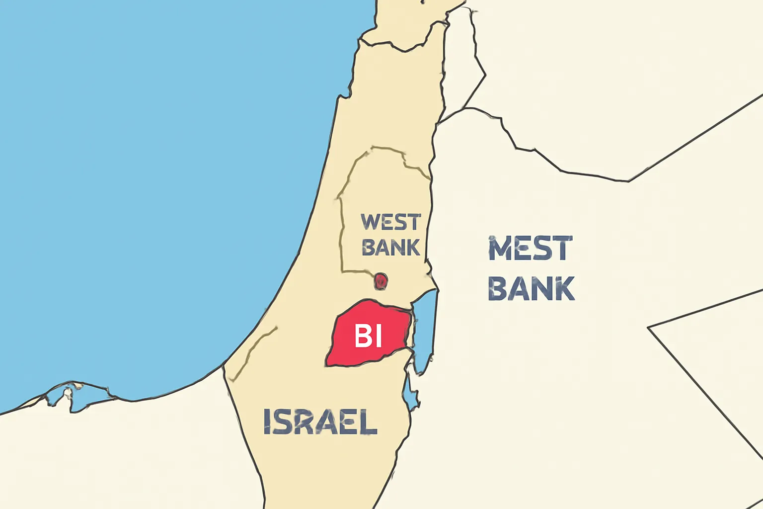
The E1 corridor is a stretch of land located to the east of central Jerusalem, extending toward the adjacent Israeli settlement of Ma’ale Adumim. On the E1 map, this area is depicted as a corridor that would physically link the urban footprint of Jerusalem with the northern and eastern edges of the West Bank settlement network. In brief, the Israel E1 map depicts a plan to create a continuous east–west linkage that would run roughly along a corridor between the outskirts of Jerusalem and Ma’ale Adumim, threading through topographic features and preexisting roadways. The visual representation of the E1 map emphasizes a development zone that encompasses housing, infrastructure, and public spaces, and it has become a symbol of how planning choices can shape the borders and the growth pattern of a major city.
In discussing the E1 map, it is important to distinguish between two related but distinct ideas: the official planning documents that describe zoning and development, and the on-the-ground reality of land status, security considerations, and political sovereignty. The israel e1 map exists as a planning reference primarily for policymakers, developers, and observers of regional geography. It is a useful tool for understanding potential future urban form, even as the actual realization of those plans depends on political decisions, security considerations, and international diplomacy.
Historical context: how E1 developed into a map of controversy
The story of the E1 corridor begins in the broader arc of Jerusalem’s expansion and the long-running conflict over land, borders, and sovereignty. Since the late 1990s and into the 2000s, planning authorities considered a corridor that would physically connect the city of Jerusalem with Ma’ale Adumim, a major Israeli settlement east of the city proper. The concept gained particular traction after 2000, when planning frameworks began to formalize the notion of a continuous corridor that could accommodate housing, commerce, and critical infrastructure. The E1 map in those years appeared as a schematic to guide debates over urban development, security zones, and demographic projections in a highly sensitive area.
The arc of policy around the israel e1 map is inseparable from broader debates about the path to peace and the status of East Jerusalem. For many Palestinians and international observers, the E1 corridor is not only a planning question but a political signal: a corridor that could physically separate East Jerusalem from surrounding Palestinian territories and complicate the prospects for a future two-state arrangement. For supporters of the plan, the E1 development represents a method to manage growth, improve transportation links, and create a cohesive metropolitan area around Jerusalem. The result is a map that has become a flashpoint in discussions about settlements, borders, and the feasibility of various peace proposals.
Key moments in the timeline of the E1 map
Early conceptualizations of a connected corridor between Jerusalem and Ma’ale Adumim.
Formal planning stages in which zoning, housing projects, and infrastructure were proposed within the E1 area.
International reactions and concerns about settlement expansion and its implications for a possible two-state solution.
Shifts in political emphasis and pauses or accelerations in development depending on government coalitions and regional security conditions.
To understand the E1 map, it helps to identify surrounding geography and notable reference points. The corridor sits to the east of central Jerusalem and lies along a corridor toward Ma’ale Adumim. Key waypoints on the map often referenced by analysts include:
Jerusalem’s urban edge to the west, where the dense neighborhoods of the city meet the transition zones that feed into the E1 planning area.
Ma’ale Adumim, the large Israeli settlement to the east, which is the anchor point for the corridor’s eastward expansion.
Highway 1 (the main arterial route connecting Jerusalem with Tel Aviv and the coastal plain), which intersects with or runs near the E1 area depending on the exact map edition and zoning proposals.
Topographical features that influence drainage, slopes, and land use, all of which are reflected in the map’s depiction of the E1 corridor’s width and shape.
The map’s visual language emphasizes a deliberate configuration: a linear or near-linear strip that would mediate connections between urban cores. In many versions of the Israel E1 map, this corridor is shown as a defined zone with parcels designated for residential development, mixed-use neighborhoods, and supporting infrastructure, surrounded by areas designated for open space or conservation. Understanding these elements helps readers see why the E1 plan is read by different stakeholders as either a practical urban project or a symbolic political move.
The E1 planning map has often been described in planning documents as a framework for future growth. The potential developments attributed to the E1 area typically include:
New housing units to accommodate population growth and reduce housing pressure on central Jerusalem.
Commercial centers and service hubs to serve the resident population and improve regional economy.
Public amenities, parks, schools, and healthcare facilities integrated into the urban fabric of the corridor.
Major transportation infrastructure, including road improvements and potential mass transit options to improve east–west and north–south connectivity.
Critically, the E1 corridor map raises questions about land use balance, environmental impact, and long-term demographic projections. Urban planners examine how a corridor with dense housing and infrastructure would interact with surrounding rural and Palestinian zones, including considerations of water resources, waste management, and ecological corridors. The map also influences decisions about lighting, security measures, and accessibility, all of which shape the daily lived experience of residents and visitors alike.
Transportation and mobility implications
One of the central hooks of the israel e1 map is the potential for improved mobility. Proponents argue that a coherent corridor would enable better regional transit, reduce congestion on central routes, and provide a more integrated connection between Jerusalem and the broader urban fabric of the West Bank settlements. Critics contend that such improvements could accelerate settlement expansion and alter commuting patterns in ways that complicate negotiations over borders and sovereignty. In the E1 map, transportation planning is therefore inseparable from political considerations, and it remains a central topic of debate for policymakers, residents, and international observers.
The E1 map sits at the intersection of urban planning and geopolitics. For many, it is a symbol of the dynamic tension between growth and sovereignty in Jerusalem. The corridor’s potential to connect a West Bank settlement to the city raises questions about the viability of a continuous corridor that bypasses Palestinian spaces, which, in turn, influences opinions about the possible shape of a future peace agreement or two-state solution.
When discussing the Israel E1 map, it is essential to recognize the diversity of perspectives:
Supporters emphasize orderly growth, housing supply, and practical infrastructure that could benefit residents in the region.
Opponents highlight risks to the contoured geography of East Jerusalem, possible fragmentation of Palestinian areas, and challenges to a negotiated settlement.
International voices often frame E1 developments as part of a broader discourse on settlements and the preconditions for negotiations, urging moderation or moratoriums in certain contexts.
These debates illustrate why the E1 corridor map remains not just a planning document but a political instrument that different actors read through different lenses. The ongoing discussion around the E1 planning map reveals how urban design decisions can become entangled with questions of rights, identity, and the future of Jerusalem.
In practice, the fate of the Israel E1 map has been mixed with pauses, revisions, and shifting political will. Construction schedules, zoning approvals, and budget allocations for projects within the E1 area have often experienced interruptions due to political changes, security considerations, or diplomatic pressures. The status of development can vary from one period to another, with some administrations signaling intent to advance components of the plan, while others defer or modify aspects of the project in response to domestic politics or international responses.
Observers of the E1 map of Jerusalem frequently differentiate between theoretical or proposed plans and actual ground-breaking activity. It is not uncommon to find that the map remains a planning artifact with endorsements and disagreements rather than an immediately actionable schedule of construction. For researchers and visitors examining the E1 corridor map, the real-world status often rests on official announcements, court rulings, tenders, and security assessments that accompany any major project within a contested territory.
Another layer of complexity tied to the E1 map concerns security and environmental policy. A corridor of this scale necessitates careful management of border controls, road access, and monitoring to ensure safety for residents and workers. Environmental impact assessments are part of the planning process to evaluate effects on natural habitats, water resources, and landscape integrity. The presence of a new corridor can also influence traffic patterns, noise levels, and the preservation of culturally or historically significant sites in the surrounding areas. When evaluating the Israel E1 map, it is important to weigh these practical considerations alongside the political implications.
Reading the E1 map effectively requires an approach that blends geography, planning principles, and current events. Here are practical tips for engaging with the map in a thoughtful way:
Consult multiple versions of the map to understand how revisions reflect changing policies or negotiations.
Review accompanying planning documents, which specify zoning codes, land use designations, and transportation plans within the E1 corridor.
Cross-reference with political developments and announcements from government agencies, opposition groups, and international actors to understand how the map is interpreted in context.
Consider environmental and social impact assessments to gauge potential consequences for nearby communities and ecosystems.
For educators and students, the Israel E1 map provides a case study in how cartography intersects with politics. A well-rounded examination might compare the E1 corridor map with other urban expansion projects in politically sensitive regions to highlight how planning, security, and diplomacy shape the built environment.
To capture the full semantic breadth of discussions around this topic, researchers and readers often encounter a variety of expressions that refer to the same core concept. Examples include the E1 planning map, the E1 zone map, the E1 corridor planning document, and the Jerusalem E1 development map. In media coverage and academic writing, you may also see phrases such as the Jerusalem E1 corridor, the E1 project plan, or simply the E1 area. Each variation signals a slightly different emphasis—whether on planning specifics, political controversy, or geographic layout—yet all refer to the same essential corridor that sits to the east of Jerusalem and toward Ma’ale Adumim.
Beyond the borders of Jerusalem, the Israel E1 map sits within a broader regional narrative about settlements, borders, and the possibility of a two-state arrangement. The corridor’s existence on the map no longer exists in isolation; it is intertwined with negotiations over sovereignty, security arrangements, and the future status of East Jerusalem. Analysts often situate the E1 corridor within debates about the shape of a potential Palestinian capital, the configuration of Jerusalem’s urban sphere, and the role of international diplomacy in shaping planning outcomes. In this light, the E1 map is not merely a plan for dense housing or improved roads; it is part of a living conversation about how cities grow while political solutions are pursued.
For residents, the plan represented by the Israel E1 map could imply changes in daily life, including new housing opportunities, changes in traffic patterns, and the availability of new public services. For visitors and researchers, the corridor offers a distinct lens on how urban design can reflect and affect political realities. Even if portions of the plan are paused or modified, the map remains a useful reference for understanding potential futures and the trade-offs that planners and policymakers consider when balancing growth, security, and diplomacy.
The E1 corridor map encapsulates a critical question about how a city like Jerusalem grows while facing enduring regional tensions. It illustrates how planning documents—whether described as the Israel E1 map, the E1 planning map, or the E1 zone map—can become focal points for competing visions of space, sovereignty, and identity. As the status of the E1 project evolves, the map remains a symbol and a tool: a reference for debates about urban form and a reminder of how geography and politics are inextricably linked in shaping the city’s future.
Readers should approach the Israel E1 map with an awareness of multiple perspectives and a willingness to follow developments over time. Whether you study the E1 corridor map for its technical planning content or its political dimensions, the corridor represents more than lines on a page—it represents the complex interactions between land, people, and power that define Jerusalem and its surrounding region.