Israel Bible Map: A Comprehensive Guide to Biblical Locations
An Israel bible map is more than a simple pinboard of sites; it is a layered tool that helps readers, students, travelers, and researchers explore the geography behind biblical narratives. Whether you approach it as a devotional aid, a scholarly resource, or a travel planner, the map serves as a bridge between text and terrain. In this guide, you will find an expansive overview of how these maps are created, what they depict, and how to read and use them with confidence. You will also encounter practical recommendations for evaluating different map types, recognizing core regions, and engaging with biblical locations in Israel in a respectful and informed way.
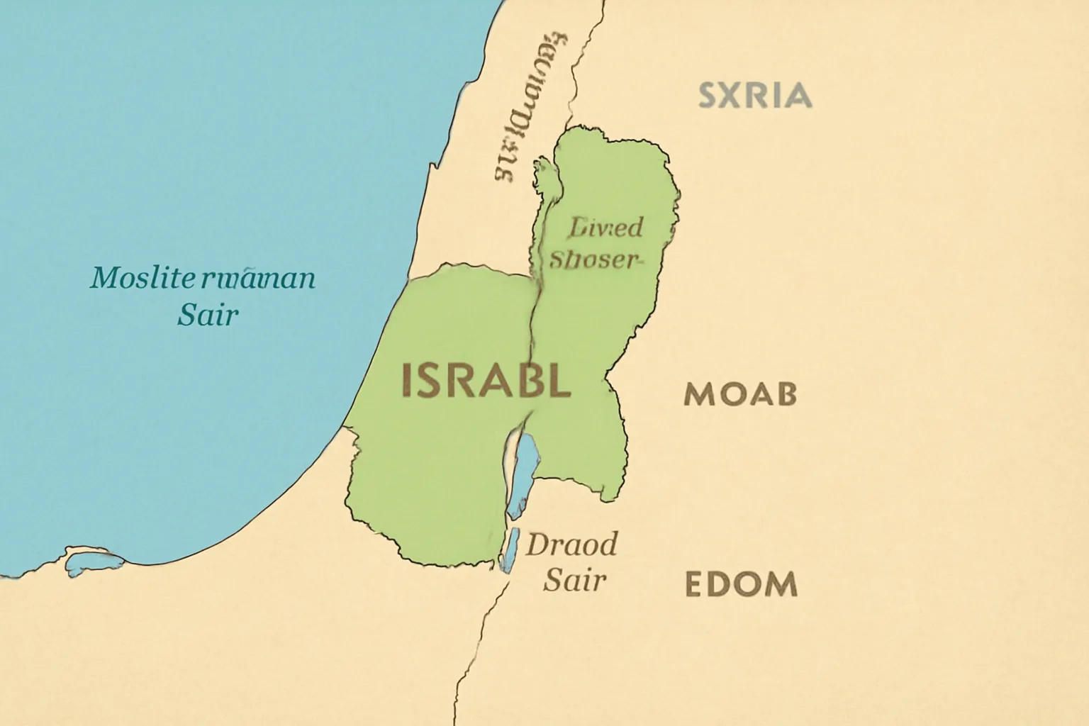
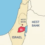
The term Israel bible map often refers to a range of map types that focus on the geography described in the Hebrew Bible (Old Testament) and the New Testament, situating places like cities, rivers, routes, and boundaries within the land historically known as the Land of Israel. Modern maps may blend biblical labels with contemporary political boundaries, while scholarly maps emphasize ancient borders, tribal divisions, and historical routes. Throughout this article, you will see variations of the phrase Israel bible map used to reflect different emphases—such as the biblical map of the land of Israel, the map of biblical locations, or the Holy Land map—while keeping the core idea intact: locating biblical events in space.
Why ancient geography matters for biblical study
Geography shapes meaning. The physical landscape—mountain passes, river junctions, desert expanses, and coastal plains—frames how biblical writers describe journeys, battles, covenants, and miracles. A reliable Israel bible map helps you:
Trace the routes of patriarchs, exodus, and conquest, gaining a clearer sense of distance, time, and terrain.
Understand how geography influenced political power, trade networks, and cultural exchange in various eras.
Relate place names to their biblical narratives, recognizing where a city’s role changes across time or under different rulers.
Distinguish between symbolic geography (thematic or theological framing) and historical geography (archaeologically grounded locations).
When you study an Israel bible map, you are not merely memorizing places—you are building a spatial intuition for how the biblical world came to be described and remembered. This spatial awareness enriches sermon preparation, classroom discussions, and personal reading by connecting stories to their landscapes.
Core regions you’ll encounter on the Israel bible map
A comprehensive map of biblical locations typically highlights several core regions that recur across biblical periods. Each region contributes distinctive topography, cultural geography, and historical contexts to the narratives you read.
The Coastal Plain and Sharon Plain
Along the Mediterranean Sea, the Coastal Plain and the adjacent Sharon Plain host ancient cities mentioned in maritime trade and coastal administration. On a biblical map, you may see sites associated with trade, port towns, and early urban development. The geography here is relatively flat, conducive to caravan routes and early road networks that connected inland communities with seaports.
The Jezreel Valley and the Hill Country
The Jezreel Valley (also called the Plains of Esdraelon) is a fertile watershed between the mountains of Galilee to the north and the hill country toward Samaria and Judah. On a biblical map, this valley appears as a crossroads of military campaigns and prophetic activity. The surrounding central highlands and mountain range—home to cities like Nazareth, Samaria, and Bethel—shape routes that recur in the narratives of judges, kings, and prophets.
The Shephelah, the Coastal Range, and the Central Highlands
The Shephelah (low hills) lies between the coastal plain and the Judean mountains, featuring a rugged landscape that influenced border dynamics between rival powers. The central highlands connect pivotal sites such as Jerusalem, Bethlehem, and Hebron. On an Israel bible map, these zones reveal how terrain affected fortifications, agricultural zones, and pilgrimage routes.
The Jordan Rift Valley and the Transjordan
The Jordan Rift Valley is one of the most dramatic geographies in biblical literature, forming a natural channel from the Sea of Galilee to the Dead Sea. Transjordan (the lands east of the Jordan) contains key sites associated with ancient kingdoms, nomadic cultures, and prophetic activity. Maps that include the Jordan River, the Dead Sea, and the Edomite, Moabite, and Ammonite regions help readers trace cultural influences that extended across modern borders.
The Negev and the Aravah Desert
The Negev desert plateau is a defining feature of southern Israel. On a biblical map, the Negev often marks journeys into the southern kingdom of Judah, as well as the Sinai narratives and the wilderness periods. The Aravah Valley and desert routes illustrate how movement through arid landscapes shaped survival, encampments, and desert spirituality.
The Galilee and the Golan
In northern Israel, Galilee and the Golan Heights are rich in both historical sites and natural beauty. Galilee is routinely associated with Jesus’ ministry in the New Testament, while the Golan features a landscape of ancient fortifications, battlegrounds, and territorial shifts described in various eras of biblical history.
Key biblical sites you’ll encounter on a bible map
The following sections group places by era or thematic importance, showing how a confident reader can locate them on an Israel bible map and understand their roles in biblical storytelling.
Patriarchal and early biblical sites
Bethlehem (birthplace of the Messiah in Christian tradition; ancient Judean town near Jerusalem). On the map, it sits in the hill country south of Jerusalem and is often linked to genealogical narratives and the saga of David.
Hebron (Mamre, the cave of the patriarchs). A key site for Israelite history and tradition; typically placed in the hill country southwest of Jerusalem on most biblical atlases.
Beersheba (Beer-sheba) and the southern desert routes. This site anchors accounts of covenants and nomadic bedrock in the southern arc of ancient Israel.
Bethel and Jerualem (Jericho next door in some narratives). On maps, Bethel marks early spiritual centers, while Jerusalem is the geographic and symbolic hub in multiple eras.
Exodus, conquest, and united monarchy
Jericho (one of the earliest conquest narratives) appears near the Jordan River valley. On a map, it is often placed at a strategic gateway into the central hills from the Jordan Rift.
Megiddo (agriculture and military campaigns). This site in the Jezreel Valley is a crucial anchor for discussions about northern kingdom dynamics and biblical military history.
Dan and Beersheba (extensive networks showing the north-south reach of early Israelite culture). Dan sits toward the northern frontier, while Beersheba anchors the southern reach.
Jerusalem (Zion, the City of David). The map highlights Jerusalem’s central role across eras of kings, prophets, and temple-centered worship.
Divided monarchy, prophets, exile, and return
Samaria (the northern kingdom’s capital) features prominently in maps showing the political geography of the divided monarchy.
Mount Carmel ( Elijah’s prophetic activity) and Bethel (prophetic towns and sanctuary sites) appear as essential markers for prophetic movements.
Beersheba and the Negev desert often reappear in narratives about exile, return, and the post-exilic period.
Nazareth (Jesus’ hometown) located in the hills of Galilee; maps emphasize the rural to urban dynamics of first-century life.
Capernaum and Bethsaida (ancient fishing towns on the shores of the Sea of Galilee) highlight the Galilean ministry in gospel narratives.
Jerusalem (Temple Mount, Golgotha, and the Mount of Olives) anchors the events of Jesus’ life, crucifixion, and resurrection in the biblical record.
Beit She’an and other biblical trade routes illustrate the spread of early Christian communities along established corridors.
How to read and compare different Bible map types
The landscape of Israel bible map resources is diverse. Some maps emphasize ancient borders, while others align biblical sites with modern cities. A few practical differences you’ll encounter include:
Traditional atlas maps focus on textual alignments (tribal territories, royal routes, and temple precincts) and provide narrative context for events.
Historical geography maps emphasize chronology, showing shifts in borders, population centers, and power bases across eras such as the United Monarchy, the Divided Monarchy, and the Persian/Greco-Roman periods.
Archaeological GIS maps (Geographic Information Systems) layer excavation data, artifact finds, inscriptions, and stratigraphic evidence to propose more precise coordinates for sites.
Tourist-oriented maps balance accessibility with information, often highlighting visitor-friendly routes, interpretive signs, and accessible sacred spaces.
When evaluating an Israel bible map, consider the map’s purpose, date of creation, and source material. A map drawn from late-20th-century archaeology may differ in perceived borders from a 2020 map that integrates new excavations and satellite data. Cross-referencing several map types helps avoid overreliance on a single interpretive layer.
Tools and resources for the Israel bible map
Today’s readers have access to a broad toolbox for engaging with biblical geography. The following categories cover the most useful resources you will encounter when studying or planning travel:
Online interactive maps that allow you to pan, zoom, and toggle layers such as biblical sites, ancient trade routes, and archaeological zones.
Printed atlases and scripture study Bibles that include annotated maps, timelines, and cross-references to biblical passages.
Scholarly reference works—geography-focused monographs, encyclopedias, and journal articles that discuss site identifications, latitude/longitude debates, and historical context.
GIS and digital humanities projects that host built-in datasets for researchers who want to examine routes, topography, and site distribution computationally.
Travel guides and pilgrimage resources that incorporate practical advice for visiting holy sites, local customs, and border considerations.
As you explore these tools, keep in mind that map accuracy improves over time as new excavations, inscriptions, and satellite imaging refine our understanding of ancient geography. Always look for maps that cite their sources and explain their conventions (for example, how they label places, how they treat disputed locations, and which historical period the map emphasizes).
Practical ways to use the Israel bible map in study and travel
Whether you are preparing a classroom lesson, a sermon, a scholarly paper, or a pilgrimage itinerary, a well-chosen biblical map of Israel can enhance your work. Here are practical approaches to maximize usefulness:
Study planning: Use maps to identify how geography influenced biblical narratives—why certain journeys occurred in a particular order, why regions were central to specific covenants, or how border changes affected political power.
Cross-text collaboration: Compare biblical passages with archaeological site identifications on the map to see how textual and material evidence intersect or diverge.
Teaching strategies: Create map-based activities that require students to locate places, trace routes, and estimate distances using Bronze and Iron Age technologies.
Preaching and devotional work: Anchor sermons in the geography of places like Zion, the Jordan valley, or the Sea of Galilee to illuminate theological themes such as covenant, wilderness, or divine presence.
Pilgrimage planning: For travelers, maps can help plan efficient itineraries, identify sacred sites with contextual significance, and understand seasonal considerations for visiting.
Common myths and clarifications about biblical geography
The field of biblical geography is rich with interpretation, and certain myths persist about the accuracy and meaning of biblical maps. Here are some frequent clarifications:
Exact borders in ancient times were often fluid. Map labels such as “kingdom of Judah” or “Northern Kingdom” describe political realities that shifted over decades and centuries. Expect variation between sources.
Distances in ancient texts are sometimes expressed in ways that do not translate directly to modern miles or kilometers. Maps may show approximate routes or plausible corridors rather than precise odometer readings.
Site identifications can be debated. Some places appear on multiple maps with different identifications, reflecting ongoing scholarly discussion about archaeology, inscriptions, and textual cues.
Symbolic geography often blends spiritual meaning with physical place. Some locations are emphasized for their theological significance even if their exact historical location remains uncertain.
Preservation, ethics, and responsible engagement with biblical sites
As you engage with the Israel bible map in person or through digital media, consider ethical and preservation concerns:
Respect sacred spaces—many sites hold religious significance for diverse communities. Follow local guidelines, dress codes, and access rules when visiting.
Support responsible tourism—choose operators and guides who prioritize cultural sensitivity, contribute to local economies, and follow archaeological and conservation best practices.
Engage with archaeology responsibly—recognize that many sites are actively studied. Do not remove artifacts or disturb excavation zones; rely on official channels for information and access.
Credit sources—when using maps in writing or teaching, cite the map type (traditional atlas, GIS map, or interactive tool) and the date of publication to reflect methodological context.
Putting it all together: a guided approach to building biblical literacy through maps
A thoughtful engagement with the Israel bible map invites you to develop a habit of cross-referencing texts with geography. Here is a suggested workflow for students, teachers, and curious readers:
Choose a map type that fits your objective—an atlas map for narrative context, a GIS map for data-driven analysis, or a travel-oriented map for planning a visit.
Identify a biblical passage or narrative you want to explore, and locate the central places mentioned.
Trace the routes, noting terrain features (mountains, valleys, rivers) that would affect travel and logistics in ancient times.
Annotate the map with dates or era labels (e.g., Iron Age, Bronze Age, Persian period, Hellenistic period) to frame historical context.
Compare multiple map sources to see where scholars agree and where they differ; pay attention to the methodology behind each map.
Reflect on how geography contributes to themes in the text—covenant, exile, pilgrimage, or divine presence—rather than merely locating sites.
Conclusion: the enduring value of the Israel bible map
An Israel bible map is a dynamic instrument that deepens our understanding of biblical texts by situating them in the real world. It connects scriptural moments to landscapes, routes, and cities, helping readers envision journeys undertaken by patriarchs, prophets, and apostles. Whether you are delving into ancient histories, preparing sermons, organizing a study group, or planning a meaningful pilgrimage, the map of biblical Israel serves as a companion that invites curiosity, fosters critical thinking, and enhances appreciation for the profound historical and spiritual geography that underpins the biblical story.
As you continue to explore biblical locations in Israel, you will discover that maps are not static diagrams but living tools. They evolve with new discoveries, scholarly debates, and the evolving understanding of how ancient peoples interacted with their landscape. Embrace this evolving nature, use a range of map types, and let geography illuminate the narratives you study and the places you may someday walk in reverent exploration.