Introduction: Why a Map of the Ancient Israelite World Matters
The study of ancient Israelite geography sits at the intersection of archaeology, biblical studies, and historical cartography. A well-constructed map of the land of Israel in antiquity does more than place towns on a parchment; it provides a framework for understanding how people moved, traded, worshiped, and organized their communities. When we speak of an ancient Israelite map we are discussing a set of tools—texts, landmarks, and inferred routes—that help readers navigate a landscape that existed long before modern borders. This article offers a guide to biblical geography and landmarks, focusing on how scholars reconstruct, interpret, and use maps of the ancient Israelite world. We will use variations such as ancient Israelite cartography, proto-cartography of Israel, and biblical geography maps to reflect the breadth of the field and to acknowledge that any single map is an approximation grounded in interpretation.
What is an ancient Israelite map, and what can it teach us?
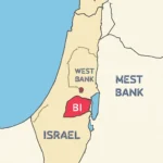
An ancient Israelite map is not always a single, hand-drawn scroll with precise scale. Rather, it is a composite representation drawn from biblical narratives, archaeological discoveries, and geographic markers that survive in place names, inscriptions, and the memory of travelers. In this sense, such a map is often best understood as regional geography rather than a modern projection. It emphasizes tribal territories, key cities, routes of travel, natural boundaries, and features that defined daily life—water sources, hills, valleys, deserts, and the sea.
The study of biblical geography is inherently interdisciplinary. It requires careful reading of ancient texts, attention to the hydrology of the Jordan River system, the strategic significance of the Dead Sea and Sea of Galilee, and the way ancient peoples oriented themselves toward Jerusalem as a spiritual center. A robust proto-cartography of Israel blends what the text describes with what can be inferred from the landscape and from surrounding cultures. The result is a set of maps that illuminate how people understood their borders, sanctuaries, routes, and economies.
In this guide, we will cover not only the terrain but also the landmarks that anchor biblical memory: cities like Jerusalem, Samaria, Megiddo, and Hazor; the zones that held tribal allotments; and the natural features that shaped travel, trade, and communication. We will also discuss how modern scholars reconstruct these maps using geography, archaeology, and GIS technology.
Historical context: what areas did ancient Israelites call home?
The landscape of the ancient Israelite world was not uniform. It comprised multiple zones, each with its own characteristics and uses. To appreciate an ancient map of Israel, it helps to understand these regions as a palette rather than a single color.
Coastal Plain and Port Cities: Running along the Mediterranean, this strip housed prominent trade hubs such as Ashkelon and Ekron, linking the interior to the sea and enabling long-distance commerce.
Central Highlands and Judean Hills: A rugged backbone where cities like Jerusalem were sited, offering defensible terrain and access to water sources.
Sharon Plain and the Shephelah: Transitional zones that acted as a buffer between the coastal and inland areas, with fortified towns guarding approaches to the hill country.
Jordan Rift, the Transjordan Plateaus, and the Desert Borderlands: A mix of river valleys and high desert that shaped routes between northern Galilee and southern Negev, and between the settled areas and nomadic paths.
Desert and Negev: The southern expanse where caravan routes channeled trade from Africa and Arabia into the interior and where water scarcity shaped settlement patterns.
A modern reader might visualize this geography as a layered quilt: a coastal belt facing the sea, a central corridor of hills and plains, and a boundary that runs into the eastern desert and the mountains of Transjordan. The north-south axis running from the Galilee to the Negev is a recurring theme in biblical literature and in how caravans, armies, and pilgrims moved through the land.
Major regional features in an ancient Israelite map
To interpret a map of ancient Israel responsibly, one must identify key natural and political features that appear repeatedly in the sources. The following subsections outline the principal regions and landscapes that define the geography of biblical Israel.
Coastal Plain and Philistine to Phoenician corridors
The coastal plain served as a busy corridor for maritime trade and cultural exchange. While the Israelite kingdoms did not always control every port, they engaged with neighboring maritime powers, including the Philistines and various Canaanite city-states. A robust coastal map helps explain why certain cities flourished despite political fluctuations.
Central highlands: Judean hills and hill country
The Judean Hills are often depicted as a rugged, defensible environment with narrow agricultural terraces. These hills housed important religious sites and royal centers. In a historical map, the elevation and water sources in this region help explain where communities could survive winter rains and spring floods, and how they defended themselves against potential invaders.
Jericho and the Jordan Valley
The Jordan Valley and the area around Jericho present a prime example of how geography shaped early urban life. An ancient Israelite map would emphasize the river’s role as a lifeline for irrigation, travel, and trade routes moving eastward toward the desert. The Dead Sea to the south anchors the region in a unique hydrological system influencing settlement patterns near the lake’s shores.
Transjordan: Moab, Ammon, Edom—land beyond the river
The eastern lands—often grouped under the umbrella of Transjordan—include ancestral regions associated with Moab, Ammon, and Edom in later biblical books. While these areas were culturally distinct from the Israelite heartland, they remained consequential for border definitions, tribal memory, and diplomatic relations. A thorough map of the ancient world would show how these areas interacted with the core territories to form a broader political landscape.
Northern highlands and Galilee
In the Galilee and the Upper Jordan Valley, the geography blends fertile plains with rolling hills. This region is frequently highlighted in narratives about early Israelite tribes and northern kingdoms. An accurate representation would also note the proximity of the Sea of Galilee and important routes leading to Lebanon and beyond, illustrating how trade and pilgrimage shaped religious life.
Southern desert margins and the Negev
The Negev desert stretches toward the southern edge of the biblical map. Its sparse water supplies and caravan routes shaped desert towns, oasis settlements, and the movement of nomadic groups. In reconstructions, the desert acts as a powerful natural boundary that influenced military campaigns and economic activity.
Landmarks and cities that anchor biblical memory
A credible ancient Israelite map must feature the cities and sanctuaries that recur in biblical accounts. These places are not merely dots on a page; they carry layers of historical, religious, and political significance.
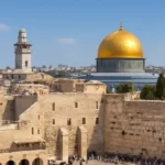
Jerusalem: A central religious and political city, often depicted as the axis around which other towns and regions revolve. In map-making, Jerusalem is typically placed in the central highlands, reflecting its geography and spiritual centrality.
Samaria (capitol of the Northern Kingdom): A major urban center whose location helps explain the dynamics between northern and southern Israel in the prophetic and historical narratives.
Megiddo and Hazor: Outstanding strategic sites with long histories of military and commercial use. Their placement on a map illustrates corridors of conquest and control across the coastal plains to the inner hills.
Beersheba and Hebron: Southern and Judean heartland sites that anchor the southern narrative and demonstrate how the southern kingdom and tribal land were organized.
Dan and Dan Spring (near the headwaters of the Jordan): Northern border markers that reflect boundaries and the integration of northern geography with the broader Israelite state.
Jericho and the Jordan River: Waterways and oases; both are critical for understanding early urban development and cross-cultural contact.
Nazareth and other Galilean towns: Provide insight into northern regional life and how northern communities connected to Jerusalem and the coast.
When scholars map these locations, they pay attention to how each site contributed to political arrangements, religious practices, and economic networks. A robust biblical map of Israel also marks sanctuaries and pilgrimage routes that traverse multiple regions, illustrating the flow of religious life across the landscape.
How we know: sources and methods for reconstructing ancient maps
The creation of an ancient Israelite cartography rests on an array of sources, each with its own strengths and limitations. No single map is definitive; rather, modern scholars assemble a mosaic from textual clues, material remains, and geographic reasoning.
Textual sources: scripture, inscriptions, and ancient travelogues
Biblical texts provide narrative geography—where cities stood in relation to one another, how borders changed with dynastic shifts, and which routes were emphasized or avoided. Inscriptions from neighboring cultures and the remains of ancient travel writings also help anchor place names and regional boundaries. The challenge is to interpret these texts with care, recognizing symbolic language, metaphor, and occasional political agendas.
Archaeology and toponymy
Excavations, settlement patterns, and material culture reveal the physical lay of the land. The distribution of fortifications, water systems, gates, and road networks informs the likely routes and scales of ancient maps. Toponymy—the study of place names—helps identify sites that match biblical references, even when the names evolved or the sites were reoccupied in different eras.
Hydrology and terrain analysis
A realistic map must account for water sources, river flows, and elevation changes. The Jordan River, the Dead Sea basin, and the terrain driving the routes between Galilee and Jerusalem are not cosmetic features; they are essential to understanding how the land was inhabited and how travel occurred. Modern techniques, including GIS (Geographic Information Systems), allow researchers to test hypotheses about routes, distances, and logistics under different historical scenarios.
GIS and digital reconstructions
Advances in digital cartography enable scholars to model potential layouts of roads, walls, and zones of influence. These digital reconstructions simulate how a traveler might have moved from one major site to another, given constraints like slope, water availability, and climate. The result is a dynamic interactive map of ancient Israel that can be updated as new findings emerge.
Reading a biblical map: what to look for
When approaching a map of the ancient Israelite world, there are several features to pay attention to in order to appreciate the decisions behind the representation.
Scale and scope: Most historical maps are broad rather than perfectly scaled. Look for regions or zones rather than exact distances. A useful map indicates the intended focus—coastal trade, inland travel, or religious pilgrimage.
Legend and symbols: Legends show how the map conveys data: camel caravans might indicate trade routes, fortifications mark military sites, and sacred spaces highlight places of worship or ritual significance.
Distances and routes: Routes between major sites can reveal the likely paths used by merchants, soldiers, and pilgrims. Note where routes converge or diverge, and how geography constrains or enables these pathways.
Political boundaries: In maps that reflect the biblically recognized kingdoms, tribal territories, or political zones, boundaries help readers understand how the region was governed and contested.
Hydrological features: Rivers, lakes, and springs are not mere decorations; they organize settlements and determine where roads are feasible. Watch for the Jordan River, the Dead Sea, and other water sources as anchors on the map.
A thoughtful reading of an ancient Israel map will reveal how geography and politics interact. For example, fortress cities along the hill country often guarded trade routes that connected the inland with coastal markets, while desert margins framed the edges of settlement and created outposts for nomads and caravans.
Interpretive challenges: limitations of ancient maps
Any map that claims to represent the ancient Israelite world must grapple with certain constraints. The maps of antiquity are reconstructed from fragmentary sources, and the distances between sites are often uncertain. Elevation data may be inferred from modern terrain rather than measured directly in antiquity. Cultural and political boundaries shifted over centuries, so a given map may reflect a specific period more than others.
Temporal variation: The borders of the kingdoms changed many times, and different eras emphasized different political centers.
Textual biases: Scriptural accounts sometimes reflect theological or literary aims rather than strict geography.
Inaccurate toponym mapping: Place names shift over time, and some sites are unidentified or ambiguous.
Scale ambiguity: A map may favor political boundaries over road networks or vice versa, depending on the intended use.
Despite these challenges, the study of ancient Israelite cartography remains fruitful. By comparing multiple sources and acknowledging uncertainties, scholars can produce maps that illuminate patterns of settlement, sovereignty, and pilgrimage without claiming to be perfect replicas.
Practical applications: using an ancient map for study and teaching
Understanding the ancient Israel geography is valuable for students, researchers, and anyone curious about biblical history. Here are practical ways to use these maps.
Curriculum planning: Use regional maps to structure lessons on the geography of Israel, focusing on how each region contributed to political power and religious life.
Textual analysis: Cross-reference biblical passages with a map to visualize where events occurred and how geography influenced narrative tension.
Archaeological interpretation: Use maps to place excavation findings in a broader context, connecting site-specific discoveries to regional patterns.
Travel and pilgrimage studies: Explore routes that ancient travelers might have followed, including commercial caravans and religious processions.
GIS-based activities: Engage students with digital mapping exercises that model routes, elevations, and settlements over time.
An educational map of the ancient Israelite world can also facilitate discussions about cultural exchange, conquest, and the ways in which geography shapes identity and memory. It helps readers appreciate the land as a character in biblical history, not merely a backdrop.
Variations in naming: diversity of terms for the same landscape
Because scholarship draws on many traditions, a map of ancient Israel may appear under various names. Recognizing these variations helps readers find sources and understand scholarly discourse. Here are common terms you might encounter:
Ancient Israelite cartography or proto-cartography of Israel
Biblical geography maps or geography of the land of Israel in antiquity
Israelite territorial map or tribal allotment map
Territorial boundaries of ancient Israel
Whether a resource uses one term or another, the underlying goal is the same: to contextualize biblical events within a physical space, and to help learners grasp how the land both shaped and reflected the lives of its inhabitants.
Sample map-reading exercises you can try
To practice with an ancient Israel map, consider the following exercises. They can be used in classrooms, study groups, or personal study to deepen your understanding of biblical geography.
Trace the route from Jerusalem to the Sea of Galilee on a regional map. Consider the elevation, river crossings, and potential obstacles travelers would encounter.
Megiddo and Hazor on different reconstructions. How do the proposed routes reflect political or military considerations?
Identify the major water sources along a journey from the coastal plain to the Judean Hills, and discuss how water availability shaped settlement choices.
Explore how the Transjordan provinces framed interactions with the core Israelite heartland. Why would borders matter for trade and diplomacy?
These exercises help reveal the economic and religious geography of the ancient world, turning abstract place names into tangible routes and decision points.
Conclusion: the enduring value of studying ancient Israelite map-making
A thoughtful examination of the ancient Israelite map offers a bridge between sacred texts and tangible geography. It illuminates not only where cities stood, but also why people built walls, established roads, and pursued particular sanctuaries. The practice of reconstructing biblical maps—whether through careful reading of scripture, careful integration of archaeology, or the use of GIS technology—helps students, researchers, and enthusiasts gain a deeper appreciation of how geography and faith intersect in the ancient world.
While no single map can capture every nuance of the ancient Israelite landscape, a well-constructed scholarly map, accompanied by robust annotations and a clear legend, can serve as a valuable educational tool. It invites readers to imagine travel across hills and deserts, to reflect on the ways in which water and trade connected communities, and to consider how sacred geography shaped memory and identity across generations. In that sense, the study of the land of Israel in antiquity remains a living discipline—one that continually refines its maps, its methods, and its understanding of how people navigated a land both beloved and contested.
Whether you approach this topic as a student, a teacher, a pastor, or a curious reader, embracing the diversity of terms and the wealth of evidence behind the ancient Israelite cartography will deepen your engagement with biblical geography and its landmarks.